Monte Vista is home to a small Amish enclave, about 30 families. As we drive through the area there are similarities to the PA and IN Amish. One big difference, they farm with tractors. I see only a couple Half-Lingers in a paddock along with lots of buggy horses. We are excited about one great constant, bakeries. We stop at” Worth the Drive” bakery and walk away with a free glazed yeast donut (nice touch), 3 fried pies, and a loaf of white bread. Pie rating: a tie between strawberry rhubarb and blueberry then pecan.
We roll through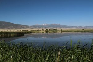 the 2 ½ mile drive at Monte Vista NWR and find lots of blackbirds and the usual collection of ducks. Nothing spectacular. I do find it amazing to move through this lush landscape in such an overall arid environment. Thankyou snow melt!
We make a stop at Bontrager Variety Store, just because. Product ranges from the everyday like shoes, hats, toys and mixing bowls to some spectacular chiming clocks. There is a section for solar panels and lithium batteries too.
We head back to camp for the afternoon but must squeeze in one more stop in Alamosa, Frosty acres Rolled Ice Cream. We watch as they prepare our choices, a Jitterbug and an El Rancho. The Jitterbug: coffee flavored cream with slivered almonds then whipped cream and caramel drizzle. The El Rancho: cream with graham cracker, chocolate and caramel drizzle topped with whipped cream and a toasted marshmallow. The process: cream is poured onto a subzero steel plate, stir-ins quickly added then all smoothed out to flash freeze. Wielding a narrow bench scraper, the artist rolls sections into a tight jellyroll shape and stacks them in your cup. Toppings are added. Voila, rolled ice cream. Great to watch and beautiful to behold. We enjoy the eating part too!

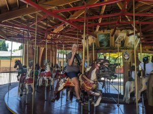 It is #72, county fair style, built in 1911 as the 72nd by Parker Amusement Abilene KS. The current complement of carved horses isn’t all the originals but they all date to the early 1900s. I am doubly excited because they even have a working band organ. Sadly, they only play it evenings so I miss out on my afternoon ride. Bummers, watching the instruments and hearing that distinct sound is a big part of the carousel experience. Still, it was a fun ride and only $0.50.
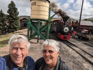 Once in town we head for the Cripple Creek and Victor narrow gage steam train. We are in mining country (gold mining up here) and this railroad runs all small engines as were used to transport ore at mines across North America. Our little engine #3 is a 0-4-0 meaning just 4 small drive wheels and no lead or trailing trolley wheels. Small but mighty it carries us out of town for a dirty, smelly trek through Cripple Creek mining history. Smoke swirls around the engine and back to the open cars carrying cinders with it. We can smell and even taste the distinct odor. I should not have worn khaki pants! It’s all over in just 45 minutes still well worth the hour+ drive up here.
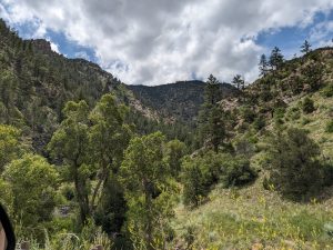
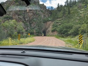 It follows the route of the 1884 Florence and Cripple Creek Railroad built to move Cripple Creek ore to the Florence smelters. It is graded dirt, narrow, winding, a bit pot-holed and wash boarded, and as we later find out includes some cool tunnels. We pass though miles of otherwise undisturbed mountain wilderness descending from 9000 feet to around 5500. At the bottom we share the narrow valley floor with a beautiful creek. Gray and green modeled granite formations with splashes of rusty red rise on either side. Some places steep and smooth other times at odd angels or sort of bulbous in shape looking like long fingers reaching into the sky or giants towering above us. Muted green of pines and juniper cover all but the steepest outcroppings with brighter green aspen intermixed. Brilliantly colored wildflowers accent exposed sunny slopes and dot recesses on the cliffs where ever they find purchase. The creek gurgles through its rock-strewn pathway with areas of the bank blanketed with brilliant green grasses. It is a wonderful drive. We see only light sprinkles of rain. There is dispersed camping along much of the valley. Looks like it might be great for a few quiet days – tent or car camping of course.
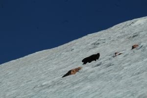 A yellow-bellied marmot prances around on the snow. There’s some chance he’s looking for a hand out. Our little pick-up made the ascent no problem.
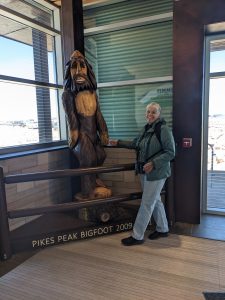
 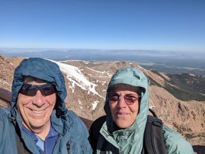 We climb out and put on all the clothes we brought with us and make our way to the visitor center. Its new since I was here with Mom and Carol. Nearly all the area is paved or platforms so very easy to get around and signboards are well done. Stop one, the snack bar and Pikes Peak donuts. The cinnamon sugar ones are definitely better. We check out exhibits and the gift shop then just relax with the view for a while.
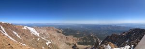
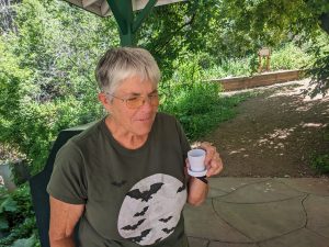 They are all some variation of salty and metallic tasting but each has its own unique flavor based on pH and the minerals it contacts as it moves underground. My thoughts, none is really great tasting but the Navajo is the east objectionable. Iron Springs is as you might expect, irony; but it is fizzy enough that it sort of grows on you. It was interesting to compare. A stop at Colorado custard is the perfect post-tasting palette cleansing.
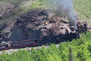 the route of our train ride on the Cumbres and Toltec. It is a beautiful drive and gives us opportunity to get some great rolling pictures of the train. We spot a few elk along the way and scope out access places to trail heads and campgrounds in the Carson and Rio Grande National Forests. This could be a great site for future adventure.
 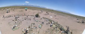 It’s been on my list
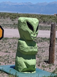
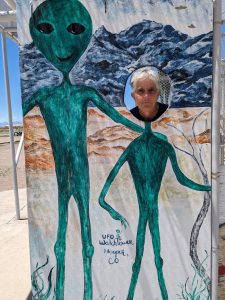
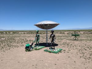
 since we got here. What a joke. It is definitely an “anything for a buck” place not the serious sort of alien believers we have found at Roswell and Marfa. Probably worth the $5 each for entertainment value!
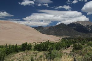 some of the forested sections that front the dunes along Medano Pass Primitive Road that tracks along Medano Creek. We know before we start that we can’t go past the 6th creek crossing since water is high and there is lots of mud. Many are getting stuck. We hope to get that far. One mile in and we encounter “deep, soft sand” warning signs with advice to reduce air pressure to navigate. Rats, too daunting. We park at “The Point of no Return” and set out on foot. Sand Ramp Trail runs along the forest edge with some nice views of the dunes but the mosquitos are thick and ruthless. We make it 2.5 miles out then turn back, actually opting to walk back the road to avoid the buggiest sections. All told we see 2 cottontails and a green tailed towhee, not a wonderful critter count. We dally a bit to wade in
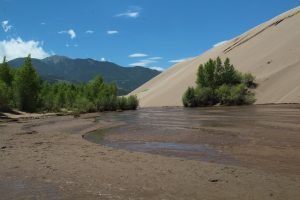 Medano Creek cooling our toes in the ever-changing flow streams. We make a couple more stops (in breezy areas) to enjoy views. We are relieved to get back to the truck but unhappy that we made the trek.
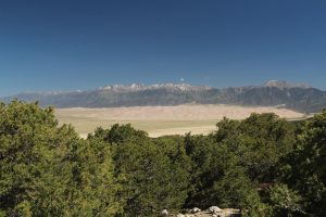 This is high desert after all! Nope, they decend upon us in clouds and even with repellant we scurry out of vegetation onto the wind-swept sand field to find relief. Medano Creek originates as snow melt high in the Sangre De Cristo mountains and wraps around this side of the dune field. It has reduced in flow since spring peak but it is still amazing to see it here. I take off my shoes and splash through the wonderfully cool braided rivulets. We witness pulse flow; a phenomenon caused as temporary sand dams in the flow form and collapse with the water flow. Pretty cool. It is a fun crossing.