Trail #742 Gila National Forest

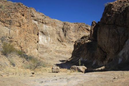
It is 48F when we get up. Hmm, pretty cool for a hike but we’ll give it a shot.  Backpack packed, boots on, water bottles filled, here we go.  The heat in the car feels good as we head for the trail head.  Hmm, the temperature drops, 45, 40, by the time we reach the trail head at 7304ft it is 36F.  Maybe we shouldn’t have worn shorts!  We are here, let’s go.  Just a couple hundred feet into the hike we cross a marshy spot where the ground is actually crunchy, TrailsnowComp_0350
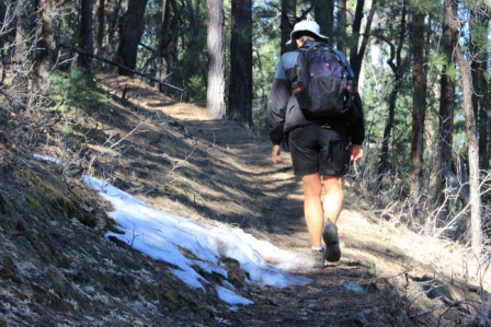
it is icy.  Once we navigate that we are reminded that we chose a Peak trail.  The switchbacks are steep and rocky and I am glad for a chance to stop and watch the birds around us.  We both are panting a bit more than anticipated.  A flat ridge section with a great viewRocks Comp_0396 
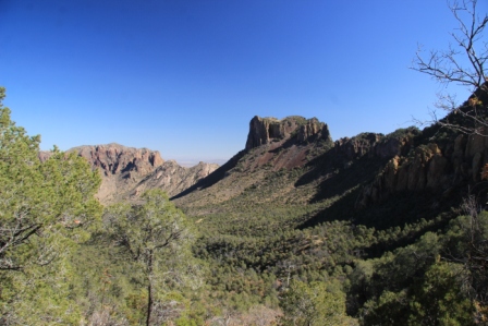
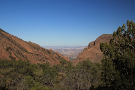
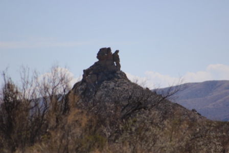
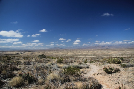
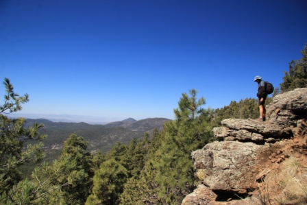
of distant mountains gives us a chance to catch our breath.  The switchbacks begin again in earnest.  What’s up?  We are taking breaks more often than either of us anticipated.  We labor on.  It is a beautiful walk through a thickly wooded mountainside.  We reach the top, Signal Peak.  TowerComp_0375
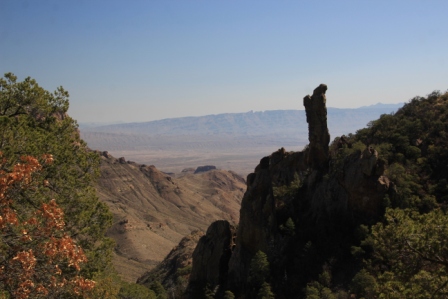
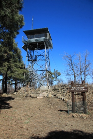
The sun is warm and we take a few to enjoy this quiet space.  Then I see the sign, elevation 8930 ft.  We climbed 1630 feet in 2 ½ miles to an altitude we flat land/lowlanders haven’t trekked through in a very long time.  It’s a good hike just allow plenty of time.
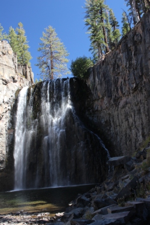
Big Bend high country

Can you say switchback? Up gravel.  Up loose dirt.  Short ones and long ones.  We walked them all Basin Grand comp_9757today then walked that many more again on our way back down.  From the Chisos Basin at around 5400 ft we trekked up Pinnacles trail to 7100 ft.  It was a bit hazy but the views were still breathtaking. BootCanyonComp_9782 From there, check out the boot rock on Boot Canyon trail.


Colima Windows Comp_9744cross trail meanders through a heavy wooded area that seems more like out in the Appalachians with oak and pine trees far outnumbering cactus and yucca. Our return trip via Laguna Meadow trail (yes, there apparently was a marshy meadow here eons ago) was not quite as steep but more of the seemingly endless switchbacks. I’d recommend the hike.  Start early though as the heat can get pretty intense even for the easier downhill portion.


These trails cut through the high country and provided our best bet for seeing the local black bear and mountain lions. No such luck.

There was a bit of heavy breathing. A month or three on the coast has definitely left us low landers.  We will need to work on that some as we head into the Rockies this summer.

Slickrock Canyon

We got brave enough to try another of the primitive desert trails and got off to a bit of a frustrating start bushwhacking through creosote and thorns of all kinds. After a couple consults with the compass we found the wash we were to follow and were on our way finding just enough cairns to keep us on track.

The canyon was cool and quiet and just as advertised, slickrock. SlickrockComp_9566  Thousands of years and millions of gallons of water do a remarkable polishing job.  A few wrens and a ravens made their presence known, otherwise we had the lovely place all to ourselves.

There is standing water in the canyon and there were javelina footprints everywhere…but no actual javelina to be found.

We started back and the day was heating up. We stopped whenever we found a bit of shade.  What’s that?  I hear geese.  Out here?  It was puzzling until we looked up, way up.  A large vee of snow geese cruised by overhead.  Fun find.  We worked our way on down the wash.  Really?  Sand Hill Cranes?  Once again, high in the sky a flock was making its way across the desert.  They slowed their forward progress to take advantage of a desert ridge thermal then disappeared from view.

Marboro Man

Marboro Man

Cool landmark that gave us guidance to return to the car when we wandered across the desert to Slickrock canyon.

We returned to camp having logged just under 10 miles and watch the sun set.. We heard the call of the coyotes.  Black tailed jack rabbits dashed around the hillsides.  Perhaps they are why the coyotes are near?

It was a lovely day and a cool peaceful evening.

Chisos Basin

Well above the desert floor we headed off on the signature mountain hike to the Window. The trail switchbacks down open desert terrain then through the ever narrowing canyon cut by Oak Creek to the point of its exit from the canyon, a magnificent slick rock pour-off.  Through the pour off we were treated to an impressive view of the desert below.  We made this hike our last visit.  Today we extended it to check out an even wider panoramic view from a shelf along Oak Creek Trail just a bit above the pour-off.  It was worth the extra bit of elevation gain.

It doesn’t happen often

We started but turned around without finishing a hike. The Old Ore Trail follows the path of an early 1900s aerial bucket tram that was used to move ore across 6 miles of desert from Mexican mines to the US.  First it follows a wash then takes off up a steep slope demanding careful foot placement and balance as we moved across the rocky steep surface.  We top one grade only to find another and another as the trail moves up and down and along gullies and washouts.  Miles of steel cable, ore buckets, and ruins of the tram line towers stretch across the desert landscape providing an outline of the long abandoned path.  Views are fantastic and we share the space with hardy desert feathered friends including cactus wrens, mockingbirds and various sparrows.  We trudge on carefully watching our feet and stopping often to take in the surroundings.  2 ½ miles into 4, I give out.  Maybe I didn’t drink enough?  Maybe our pace was too fast?  After a half hour break with snack and plenty of water I am up for the trip home but the end of the trail at the tram terminal will have to wait for another day. Kent faired better with the strenuous hike but didn’t argue too vehemently when I declared that I had to turn back.  Not exactly what we planned for the day; but still, another beautiful rugged place visited.  I’m ok with that.

Trail to Hot Springs canyon

Signs warned us that it would be a hot climb with no shade. So true.  Trail Hot SpringsComp_9009We made to the high point of the trail and a view across the desolate but beautiful Dead Horse Mountains and the cragged Chisos Peaks.  The call of cactus wrens floated across the open country where it was otherwise wonderfully silent.  Occasionally that silence was interrupted by traffic noise reminding us that even in a place like this we are never really far from the footprint of man.


Border crossing to Bougalles is open, maybe we will check it out?

Still, a stroll along the Rio Grande brings us to collections of trinkets for sale left here by the Mexican locals who keep careful watch from across the river.

Cranberry Wilderness

We came through here in 2012 but had to check out the highlights again.  A boardwalk through a bog at 4000 feet elevation.  It doesn’t seem to belong here.

Lots of stairs to the Falls on Hill Creek.  The creek runs though a beautiful wooded ravine.  It is running pretty full with all the recent rain.  It was a good walk the second time too.

We saw a Black Bear.  On a signed interpretive nature trail no less.  It was a quiet walk through a meadow, a bit of wetland (or used to be till the beavers moved out) and a forested section.  Pretty but not very exciting until about the end when I sighted the black furry lump just 20 yards or so across the meadow.  He was intently noshing on something so we watched for a bit; then he noticed us.  Looked right at us and beat it for the woods.  That was the highlight of my day!

Fantastically rugged

The geology of Kings Canyon is amazing.  The backdrop is the high sierras at over 9000 feet.  Nearer, uplifts, lava flows and major plate tilting have mangled an ancient lakebed.  Limestone and sandstone now form jagged mountains which are dotted with granite domes, pierced by granite wedges and knifed through by lava-formed dikes.  The middle and south forks of the King River have sliced through this jumble to create steep walled narrow canyons.  Yucca and desert live oak sprout from cracks and ledges along near vertical walls.  We hiked a bit but stuck to leisurely river side strolls (with a bit of rock hopping).  Many of the trails take off steeply up or down to provide the gateway to vast wilderness areas.  It would be a lot of work to back country travel around here.

Just over 9700 feet

Wow, switch backs! I’ll blame it on the thin air, I was puffing much of the time.  We worked pretty hard to take in the views high above Lake George and Lake Mary.  The destination was actually Crystal Lake.  Crystal Lake Comp_9007It is a clear alpine lake perched at just below 9800 feet.  Fall color is just starting here but it was still beautiful nestled among craggy peaks.

Devils Postpile National Monument

A corner carved out of the NF; it is just a pile of rocks, but oh so cool. Slowly cooled lava created perfectly ordered columnar basalt.devils Postpile comp_8860  The octagonal stone pillars are tightly organized and have been cut through by ages of glaciers and water.  It is much like the huge formation at Devils Tower in Wyoming but here a trail runs close enough to see the bundles of ends that look like honey comb and to walk on exposed ends that look like octagonal tiles.  Columns are straight and some bent.  What a great place for a geology (and thermodynamics) lesson.   An American Dipper made an appearance in San Joaquin River that runs along the trail.


Down river we checked out Rainbow falls. Rainbow falls comp_8926Even in this dry season it was beautiful as the flow crossed faceted rock face and fell some 100 feet.  The river creates a surprising oasis among the bare rock and sand.  The trail to the falls passes through an eerie landscape of rock and the skeletons of thousands of tree trunks snapped off at maybe 20 feet above the ground.   A huge blow-down with winds greater than 150 mph tore through this river valley in 2011 and took down everything in front of it.  They are still working to clear campgrounds and trails.

We trekked into the Ansel Adams Wilderness a bit and crossed the Pacific Crest and John Muir Trails. This would be some pretty challenging back country hiking.