National Forest Scenic Area

The Mono Basin within the Inyo National Forest was the first area to be classified as this type of preservation area.  What is it protected from you ask?  LA, they have been siphoning off fresh water from inlet springs since the 40s.  The lake level dropped over 40 vertical feet and was still falling when the protections were put in place.  It will likely never return to its previous level since LA still diverts a considerable flow but it is at least stabilizing.


A vast alkaline lake stretches across the sagebrush covered floor at this west edge of the great basin. IMono Lake Comp_8776
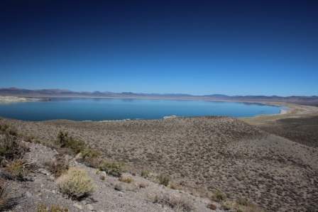
t covers 60 square miles with water 2 ½ times as salty as the oceans.  Only brine shrimp and alkali flies make it their full time home but thousands of migrating birds stop here to refuel as they head south for the winter.  The migratory importance and some really weird chemistry are the main reasons it is now protected.


Calcium rich spring waters bubble up through the floor of the lake and combine with the mineral laden lake water to createToufa Comp_8724 
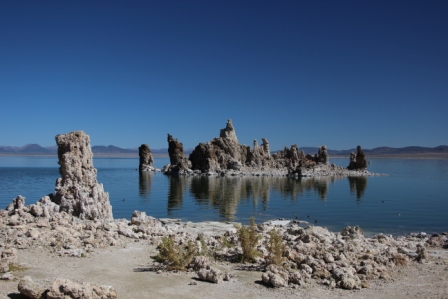
limestone crystals that gather in eerie structures that look a lot like coral or stalagmites. When the lake level drops the towers become visible along the shore.  They are fascinating.


The alkali flies are something only the birds could love. Claim is that a band several feet wide and inches deep circles the shore during peak hatch.  There are comparatively few now, fortunately.  Evidence is that early Indians dried them and ate them; they taste like buttery rice.  Ugh!  Nowadays gulls scoop them and grebes, phalenthrope, and ruddy ducks pick they from the salty waters.


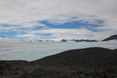
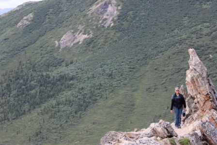
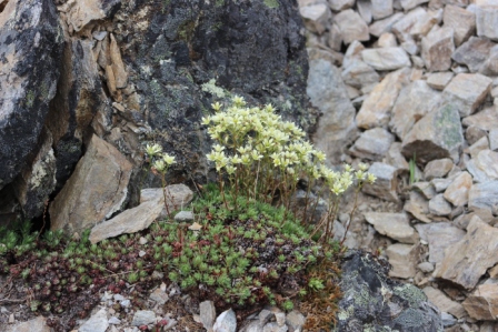
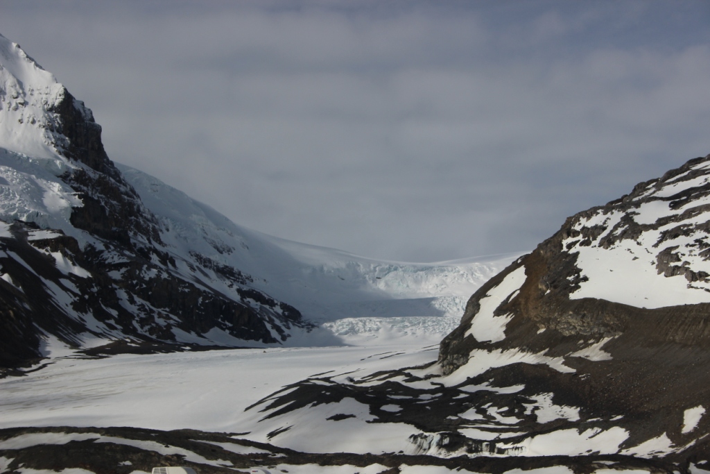
This is still volcanic country with lots of cinder cones. Some formed underwater, others into the air.  They make for great vantage points to survey the valley and snow capped mountains that encircle it.

A bit of everything here

The Inyo National Forest stretches along 395 through the Great Basin through miles of sagebrush and acres of lush forest along the mountain flanks.  It includes the largest stand of Jeffries Pines in North America.  Clear cold lakes are fed by year round snow caps.  There is lots of hiking and interesting geology.  We barely samples all there is to do.  Bring lots of clothes though, this is a place of desert temperature swings.  We woke to 27F and found 80F with blistering sun midday.

Absolutely amazing

The Harding Icefield stretches out as far as the eye can see.  Entire mountains have been encased in ice 1000s of feet thick until only isolated caps or Nunatak remain exposed.  icefields comp_6992Sometimes the ice looks smooth and bright white.  Sometimes it is crystal blue.  Folds and fractures cover the surface where the ice flows around obstacles or is pinched between rock walls.  The biggest crevices spires happen when the ice escapes from the icefield and flows down slope like at Exit Glacier.  It is awesome.

The journey up to that view was quite the experience too.

Up before daylight.  That hasn’t happened since we got to this land of the midnight sun.  It wouldn’t have happened today either except that about half way through breakfast we realized that the alarm had been mistakenly set for 5AM instead of 6AM.  OK, a really early start!

We were at the trailhead before 8AM.  It was bright and a bit cool but this trail is steep from the first few steps.  Including our mountain top wanderings we trekked 9.4 miles today and managed about 3300 feet in elevations change mostly on loooong steep switchbacks and quite a few rock steps.  We traipsed in a bit of mud and crossed a half a dozen small swift, clear, cold creeks as we moved through rainforest, tundra and bare windblown rock.  It was a lot of work but well worth it.

Critters were few.  The adorable marmots made an appearance but that’s about it.  Wildflowers dotted the trail and blanketed the tundra.  Still pools on the rocky mountaintops looked like fields of blue flowers as they reflected the brilliant sky.

The short walks to see Exit Glacier are wonderful too but if you’re here, don’t miss the Harding Icefields Trail.

A glorious sunny morning

The forecast for today is 90% chance of rain.  Thankfully the morning doesn’t show it.  The mountain is out….it is magnificent every time.  Moose Comp_5209A young cow moose hangs out for all to watch.


Today we try a strenuous hike, The Savage Alpine Trail.  First up 1500 ft then back down in about 4 miles distance.  We start the climb along a small rushing stream through thick boreal forest; singing to the bears along the way.  Switch backs bring us out onto the open tundra.  In minutes the cool steady wind has us donning jackets that we had stripped off during the climb.  Denali disappears in the clouds but the wide Savage River valley stretches out below us ringed with ridge after ridge of mountains.  Rocky Point Comp_5242The trail follows the very top of a craggy rock ridge and the wind whistles around us.


Wildflower comp_5228The larger, showy wildflowers dance in the wind while countless tiny blossoms dot the tundra with yellow, red, blue and purple.  Yellow wildflowers comp_5241Sheltered areas are perfectly designed miniature rock gardens.  It is like no other place I have ever seen.  Beautiful.


A sheltered spot behind a jumble of lichen covered boulders is just perfect for lunch.  It is a perfect home for arctic ground squirrels too.  I swatted and stomped at them the whole time we were stopped just to keep them out of my back pack.  One even gnawed on Kent’s boot.  They are a bit annoying but so cute.  We managed not to feed them though.


It is a great hike and well worth the effort.

Is this what Pigpen feels like?

Pigpen is plagued with a dirt cloud that engulfs him where ever he goes.  Picture us, doused in mosquito repellant and cocooned in our “don’t leave home without it” head nets.  As we walk, the mosquitoes follow us like a living shadow.  I can feel them running into my hands and even my clothes.  Whenever we stop they mob us and we are completely enveloped.  Pigpen, how can you stand it?   It is pretty distracting even when they aren’t biting.

The reason we braved the bugs was a hike to Marion Creek Falls.  To add to the challenge, we are apparently on a section of permafrost is this region of discontinuous permafrost.  Great.  That means that the ground is actually several feet of peat moss and lichens interspersed with tussocks of grass and low bramble; all of this on top of ice.  More than a couple footfalls turns it to uneven, ankle twisting, sloppy mush.  I have one boot full of mud and Kent one full of nice smelly water.  Now we can say that we have hiked on permafrost…and can forewarn others, it is exhausting.


Oh yeah, the falls were pretty.

Dazzling sun on snow and bone chilling rain

Day two on the Parkway had a bit of everything weather-wise.  We lucked out on the timing.

We woke to sunlight blazing its way across the face of the glacier as the sun cleared the opposing peaks.  Wisps of clouds hAthabasca Glacier Comp_3427ang among the peaks.   It is a clear, crisp 32O.  Fantastic.

Ok, moving on.

Bighorn Sheep Comp_3434

Big Horn Sheep are relaxing roadside in the warm sun.


We hike Sunwapta Falls.  Spruce Grouse Comp_3456The snow melt swollen river roars through the narrow slot and over the glacier carved cliffs.  A mile or two downstream it does it again.  It is impressive.  A Spruce Grouse makes an appearance trail side.

Ok, moving on.

In a matter of a few miles clouds close in. It mists.  It rains.  It is miserable and views are disappointedly socked in.  We stop to wait it out but nope, it’s not clearing.

We move on.

Athabasca Falls.  Athabasca Falls Comp_3489Amazingly it clears again.  We wander the trails around another extraordinary example of the raw power of pounding water.  Next to the roiling, roaring falls; we travel paths that wind through deep, narrow, steep walled channels left dry long ago when the river changed paths.

Ok, moving on.

The Icefield Parkway is billed as the most spectacular drive in the world.  It is certainly one of the most beautiful we have been on.  I highly recommend it no matter what the weather.  Allow time to get out and walk a bit to better take it all in.

We settle into camp.  Not a bad day!

Dinosaur Country

Meet an Albertosaurus, a T-Rex ancestor.  He is pretty fierce looking both in his bare skeleton form and in the fleshed out recreation and he’s the star at the Royal Tyrell Museum in Drumheller, Alberta.  This is a Smithsonian caliber museum of paleontology. Tyrell Comp_3011 Ancient seas and glacial ages have left this area of Alberta just packed with dinosaur bones.  Large bonebeds and deposits over an extended period of time have provided lots of data to refine behavior models and theories about the evolution of dinosaur species.  The end result, a museum full of jaw dropping exhibits that tell wonderfully engaging stories.

Besides the museum: Drumheller is riddled with dinosaur stuff.  Brightly painted dinosaurs dot street corners, there is a dinosaur spray park, a bright purple Dino sits in the school yard, and the visitor center has an 85 ft tall steel T-Rex that you can even climb up in…I didn’t.

We rounded out our day with a piece of Saskatoon pie (fair but not stellar), a river crossing on a cable ferry, a walk across the Red Deer River on a bouncy suspension bridge, and bit of a hike in the Alberta badlands.  It was a hundred miles sort of out of the way and I did end up with boots full of mud (cursed bentonite) but it made for a great stop.

A leg stretching stop

It turned out to be a bit more of an adventure than the average rest stop.  It started with a steep 14% grade on a winding two lane road.  Ok, that’s doable.  Then the real object of the stop. Tonto Natural Bridge SP.  Tonto Natural Bridge Comp_1402This was a chance to see a big travertine natural bridge.  Of course, we had to see it from below.  To the trails!  We climbed among boulders, that was cool.  But then, we came across the “slick rock”.  It was polished sooo smooth and with curves that were poised to launch climbers off into the pools below.  I must say, there were a few tense moments; but in the end all is well.  We got to see a magnificent example of Mother Nature’s handiwork and managed to get no wetter than the splashes from the waterfall overhead.  We definitely stretched our legs.

A day in the desert

Aqua Fria National Monument….our new focus got its first back-road experience.  It was dusty, wash boarded, washed out, and rock pocked.  There was even a creek fording.  No problem.


Brilliant fuchsia blossomsBlloming Catus_1324 on hedgehog cactus dot the rugged hillsides.  The vivid green of towering cottonwood trees follows Snake Comp_1334the contour of hidden washes.  A pretty impressive snake lies sunning on the road.  The remnants of stacked stone walls on a perfect mesa are all that tell the story of the ancients who used to call this place home.

The Pineywoods of Texas

We checked out a trail through the dense pines of Angelina National Forest.  It was a quiet walk, not a single other person out there.  Suppose the 70% humidity might have affected that?  Despite a fair bit of sweat, it was a good outing.  No sighting of the endangered cockaded woodpecker though, despite spending time in their favorite terrain.