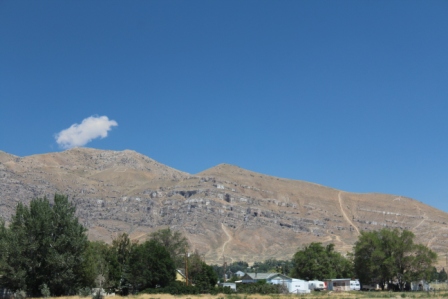
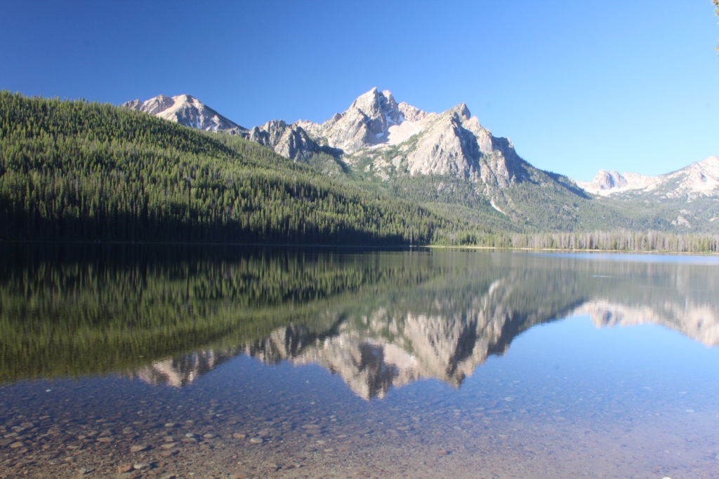
Interesting factoid

The continental divide splits in half here in lower Wyoming. How can that be you say? Where does the water in the middle go: east or west? North or south? Neither! This area in the middle is the Great Divide Basin. Water that falls here stays here and flows to neither ocean.

South West Wyoming

You are given a gray canvas, a splayed bristle brush, and two pots of watercolor, olive drab and dessert sand. Your assignment, paint a landscape. Whatever you come up with will certainly capture the essence of the view as one drives I-80 through south western Wyoming.
Long rolling valleys are bordered by wrinkled looking, clay colored bluffs. Yellow-gray arid-land prairie grasses blanket vast expanses on both side of the road. Sage brush appears as greenish-gray splotches in those blankets or dense thickets. Patches of bare earth provide the substance for towering dust devils that color the sky gray-brown. As you look across the plains the muted colors leave shapes indistinct. The constant movement of prairie grass in the wind blurs the lines even further.
I don’t think I would call this area beautiful but it is amazing in its shear size. Seeing it drives home exactly how vast this country is.

EBR-1

We saw this call out on the atlas and thought it was some sort of printing error then Kent found it on a unique things in Idaho page.  It is a real thing, a National Historic Landmark, and it is another geek stop.  Here at the Idaho National Laboratory (INL) is the first ever Experimental Breeder Reactor (EBR-1) and a museum dedicated to explaining it and it’s place in history.  We toured and read and pondered over what they had accomplished and its implications.  Incidentally, the reactor is shut down and poured full of concrete…no worries here.

The INL is a sprawling complex on thousands of acres in the middle of nowhere with 8000 employees. They run multiple programs related to Nuclear Energy with a mission to “re-establish U.S. world leadership in nuclear science and engineering.”   Hmmm.  If we knew what all they actually do there would likely be some worries about that.

While its mission is different, it sure has a lot of parallels to the facilities we saw at Hanford Reach.

On to Craters of the Moon

Along 75 from Galena Pass Galena Pas Comp_5324we can view the entire Salmon River Valley (well sort of its still smoky).  Just below us a tiny ribbon of green winds its way across the grasslands.  This is the headwaters of the Salmon River.  Pretty cool.


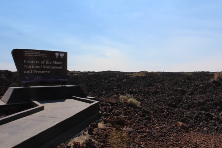
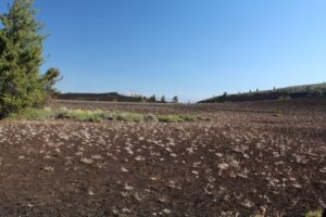
We are buzzing along checking out grasslands and watching for pronghorn. Hey, weird; it looks like giant scale ploughed field…Craters of the Moon Comp_5326  Actually, it is the first glimpse of the a’ a lava spit out thousands of years ago.  We have reached The Craters of the Moon National monument.  A line of volcanoes has deposited cinders, splattery lava, ropelike pahoehoe that is riddled with lava tubes, and great heaps of this a’ a.   We drive the drive, take a ranger hike and even explore a couple of the lava tube tunnels.  We skipped “boy scout” cave/lava tube.  Its entrance requires a belly crawl then one is greeted with standing water and maybe even a layer of ice.  Thanks anyway!  Indian TunnelIndiantubebetterComp_5409 
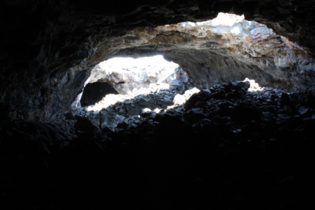
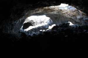
is 30+ feet high, has some holes in the roof to let light in and requires only a bit of rock scrambling to explore.  We made it the 800 feet to the far end of that one.  Beauty cave is tall enough to stand in and is also just a bit of rock scrambling but it is 300 feet long and it gets REALLLLLY dark really quick.  I found that about 50 feet in was quite enough for me. Kent ventured a bit further and caught this pic ofBeautyCaveBreath_5429 
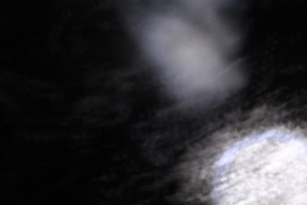
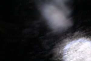
his breath. Pretty cool given it was over 90F out today.


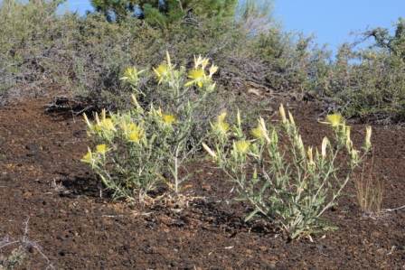
This seemingly inhospitable

Dwarf Buckwheat

Dwarf Buckwheat

place supports some great plants. Dwarf buckwheat creates these cool white splotches on the dark soil.  Check out this brightsunburstFlowerComp_5347 
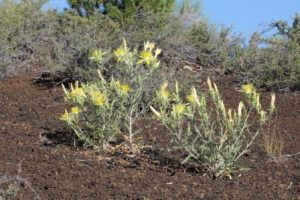
yellow smooth stem blazing star.  We caught it early in the morning.  It closes back up in the heat of the day.


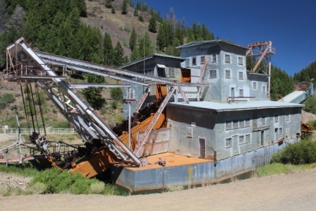
This place can bring out a bit of the rock hound in anyone.

Next stop, Rocky Mountain National Park.

Bad Hat!

A long utilized accessory made another attempt at freedom. In March 2011, I found a hat along the road in Joshua Tree National Park.  There was no way to find the owner so it was adopted.  BadHatfenceComp_5468Since that time it has sought freedom along a trail in Delaware Water Gap NP when it stayed on a rock while we continued along the trail.  Once it absence was noted I doubled back to find it being washed in a creek by a potential foster parent who returned it.  Later in Ontario it stayed on a log after a break and was homeless for 30 minutes until retrieved.  This week it stayed on a rock after a hiking break and was homeless for a couple of hours until we returned along the trail to give it a short day of hiking.  Over the years it has faded and earned some battle scars, the most notable a hole delivered by Brian and Johnna’s dog Sara when it leapt to freedom while both hands were busy painting.  Those battle scars may explain this week’s long freedom while being bypassed by many hikers.  It is back home and enjoyed the trails in Craters of the Moon National Monument today.

Bench Lakes hike above Redfish Lake

Wear and tear tells us that this is a high traffic trail sometimes but not this morning. We gain a bit of elevation then walk the ridge with great views of Redfish and Sawtooth Mountains.  We pause as a deer watches us and munches then watches us again before veering off the trail and into the pines.

A final set of steep hot switchbacks brings us to the first forest encircled lake. Mountain peaks reflect in the still surface.  All is silent and a duck creates smooth ripples as it glides across the surface.

We bushwack our way to lake number two,BenchLake2Comp_5283 since we didn’t’ see that the trail actually skirted the lake on the other side. We are rewarded with another pool.  We notice a family camp near the shore but all is peacefully silent.  Then we hear it, “Mom, Dad.  Mom, Dad.  There are people here.”  Guess they had had the place all to themselves up til we showed up.  We find a seat on a fallen log near the waterline and stay for a few.  We  agree that we could probably enjoy some time here, especially those few evening and overnight hours when even just a few miles out one can feel that they are the only people on earth.

It is noon time and the midmorning hikers are arriving so we bid our peaceful perch farewell and head down to the beach at Redfish Lake for a dip.  It doesn’t take long to cool off then not long to warm up as the lake is pretty cold but sun toasty warm.

RedfishLakeSunsetComp_5318

Back at camp the smoke is rolling in again. We head back to the Sawtooth view across Redfish Lake to check out the sunset.

All around Stanley

There is (at least was) gold in them there hills. A number of the side creeks that feed the Salmon River have been dredged.  YankeeForkDredgeComp_5140Those huge floating dirt sorters dug down to bedrock as they were floated down narrow ravines.  Yankee Fork ravine looks just like the dredged fields in Alaska with row upon row or rejected rubble piled in arcs for nearly 6 miles.  A local non-profit, The Yankee Fork Dredge Association has restored the old dredge and gives tours.  Walking through the actual equipment gives one a better idea of the actual scale of this operation.  The dredge is 112 feet long and the 71 buckets, eight cubic feet each, fed their loads to the dirt sorting monster every three minutes.

Where there was mining there are ghost towns. We visited Custer, a mill town just up the valley from the dredge that in its haydey processed ore from many local mines.  They have some cool antiques and tell a great story.  We could have panned for gold….we chose not to.


In the Stanley Museum we learn of the pioneers, miners, fur trappers, and ranchers that have called this valley home.


Did you know that when people spent ration coupons they got cellulose change? Yeap, they had samples of them at the museum. They were color coded for denomination and printed on to indicate whether it was for sugar or meat or gas or whatever.  I guess it makes sense but I have never seen anything but the ration books.  Cool tidbit.