
Kent has been itching to drive up this mountain. Today is the day. We sign up for the 8-10 time slot and find the highway nearly to ourselves as we set out. The super helpful gate keeper hints that we save enroute stops for the downhill. It is supposed to get very windy later in the morning. Sounds smart. Kent sticks to the speed limit as we climb and swish through first smooth curves then tight switchbacks. I’m pretty sure he is enjoying it! We near the top. The outside temperature has dropped to 39 and the wind already pretty strong. 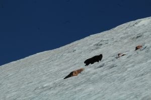 A yellow-bellied marmot prances around on the snow. There’s some chance he’s looking for a hand out. Our little pick-up made the ascent no problem.
 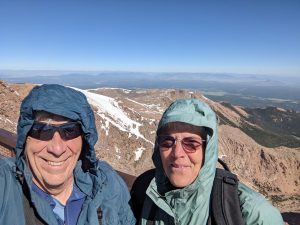 We climb out and put on all the clothes we brought with us and make our way to the visitor center. Its new since I was here with Mom and Carol. Nearly all the area is paved or platforms so very easy to get around and signboards are well done. Stop one, the snack bar and Pikes Peak donuts. The cinnamon sugar ones are definitely better. We check out exhibits and the gift shop then just relax with the view for a while.
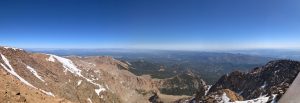
We are both noticing 14000 foot elevation! Going down. We make an emergency stop as one of those adorable but obviously not brilliant marmots dashes in front of us. We pull off at nearly every stop on the way back down to oh and ah at the views and check for wildlife on the high meadows. Unfortunately, no luck with that. Kent might share his own take on it but from my perspective, it was a fun day.
They are big on sasquatch on the mountain.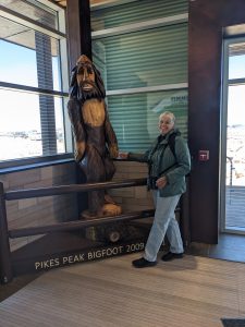
We make a short stop in Manitou springs for a spring water tasting tour. Town is busy and parking is a pain but we do find a spot and sample 5 of the 8 springs from varyingly ornate bronze fountains.  They are all some variation of salty and metallic tasting but each has its own unique flavor based on pH and the minerals it contacts as it moves underground. My thoughts, none is really great tasting but the Navajo is the east objectionable. Iron Springs is as you might expect, irony; but it is fizzy enough that it sort of grows on you. It was interesting to compare. A stop at Colorado custard is the perfect post-tasting palette cleansing.
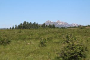
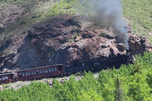 the route of our train ride on the Cumbres and Toltec. It is a beautiful drive and gives us opportunity to get some great rolling pictures of the train. We spot a few elk along the way and scope out access places to trail heads and campgrounds in the Carson and Rio Grande National Forests. This could be a great site for future adventure.
 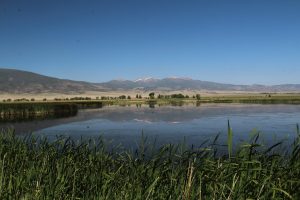 the 2 ½ mile drive at Monte Vista NWR and find lots of blackbirds and the usual collection of ducks. Nothing spectacular. I do find it amazing to move through this lush landscape in such an overall arid environment. Thankyou snow melt!
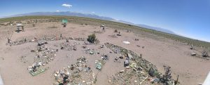 It’s been on my list
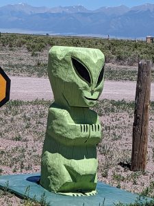
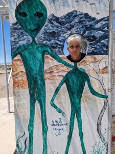
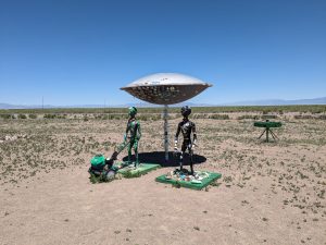
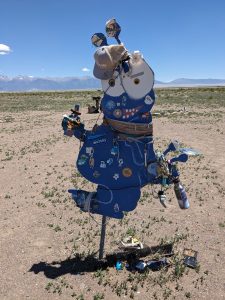 since we got here. What a joke. It is definitely an “anything for a buck” place not the serious sort of alien believers we have found at Roswell and Marfa. Probably worth the $5 each for entertainment value!
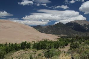 some of the forested sections that front the dunes along Medano Pass Primitive Road that tracks along Medano Creek. We know before we start that we can’t go past the 6th creek crossing since water is high and there is lots of mud. Many are getting stuck. We hope to get that far. One mile in and we encounter “deep, soft sand” warning signs with advice to reduce air pressure to navigate. Rats, too daunting. We park at “The Point of no Return” and set out on foot. Sand Ramp Trail runs along the forest edge with some nice views of the dunes but the mosquitos are thick and ruthless. We make it 2.5 miles out then turn back, actually opting to walk back the road to avoid the buggiest sections. All told we see 2 cottontails and a green tailed towhee, not a wonderful critter count. We dally a bit to wade in
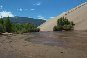 Medano Creek cooling our toes in the ever-changing flow streams. We make a couple more stops (in breezy areas) to enjoy views. We are relieved to get back to the truck but unhappy that we made the trek.
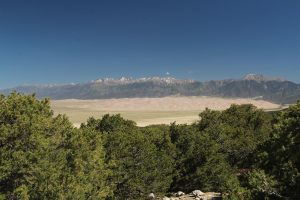 This is high desert after all! Nope, they decend upon us in clouds and even with repellant we scurry out of vegetation onto the wind-swept sand field to find relief. Medano Creek originates as snow melt high in the Sangre De Cristo mountains and wraps around this side of the dune field. It has reduced in flow since spring peak but it is still amazing to see it here. I take off my shoes and splash through the wonderfully cool braided rivulets. We witness pulse flow; a phenomenon caused as temporary sand dams in the flow form and collapse with the water flow. Pretty cool. It is a fun crossing.
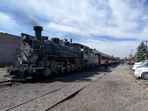 It was built around 1925 by Baldwin Locomotive.
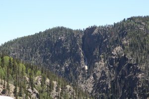
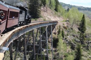
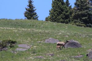 The route passes through steep-walled river-carved ravines and broad U-shaped valleys cut by glaciers, the rail bed sometimes carved into cliff faces or twisting past steep rocky cuts; most notable Toltec Gorge. We cross Cumbres Pass through the San Juan Mountains at 10,015ft elevation. From Chama to Osier (about half way) the route spends much of its mileage climbing, including plenty of 4% grade so we have lots of opportunity to hear and watch the engine really work. Best views come in the stacked tight curves laid out to make the climb without exceeding possible grade. There are tunnels and trestles of course. We spot wildlife too; elk, some a binocular distance and even a small band bedded down just 100 ft or so from the track. There are pronghorn, a mule deer, and prairie dog. An earlier trip saw black bear but not us. Scenery is spectacular nearly the whole ride leaving me to comment more than once,” I could live here”, as we roll past 1800 homesteads and modern cabins dotting the wide valleys. Sage brush plains near Antonito are not amazing to look at but they do provide opportunity for pronghorn sighting.
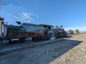 The older locomotive, 463; owned by the city of Antonito, runs the less demanding Antonito side.
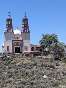
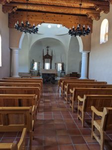
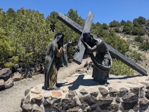 oldest town in Colorado. We check out a major attraction, The Shrine of the Stations of the Cross, built by/funded by the Sangre de Cristo Parish. The bronze statues are amazingly detailed. I can’t avoid a lapse into the technical, what a magnificent application of lost wax bronze casting.
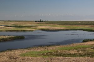 bird and wildlife watching. Neary all of the foot trails are closed to protect the breeding grounds of the endangered Southwestern Willow Flycatcher but there are a couple drives to check out. Wetland habitat is home for mallards, blue winged teal, yellow headed and lots of red wing blackbirds. We spot a Virginia Rail as it crossed the road in front of us, one bird we rarely get such a good look at. Bluff Overlook drive runs along a ledge with a wide view of the San Luis Valley. There are elk and odd-looking rock ledges turn out to be large herds of sheep tightly clustered together moving like a single mass.