Here we go, our first full-blown Bluegrass Festival. I’ve heard bluegrass groups at various festivals and summer concert series through our travels. Most recent was while we were in Kingston this summer. That is when I vowed that we are going to seek out more of this bluegrass/mountain style music and really check it out. Here we are in Westcliffe, Colorado dry camping in an open field under clear (most of the time) skies soaking up sunshine and bluegrass.
Skip to Sunday, performances are coming to a close. We went all in. Across the 3 ½ day festival we spend 24 hours in lawn chairs under a huge tent listening to the likes of Hillbilly Fever, Uncle Shuffelo and this Haint Hollow Hootenanny, Blue Canyon Boys and Southwest Bluegrass All Stars plus lots more. Many of the groups, and/or their individual members, are well known in this genre and I’m certainly impressed with the picking and strumming everywhere not to mention the amazing washboard playing in the Uncle Shuffelo group!
Kent and I are obviously not qualified to objectively judge what we have been listening to but we have picked out some standouts, in our opinions. For me it is The Red Mountain Boys. They are a bit non-traditional I’d say. They played original music, both lyrics and instrumental which seem to incorporate a fun interplay of all the string parts with breakouts of genre-defining finger-defying picking, especially on the mandolin. My favorite song is Dear John. I get the distinct impression they were all high on their last set…lots of ‘I know something you don’t’ grins exchanged and pretty loose demeanor by all.
I think Kent’s vote would be the group DAYTON; heavily influenced by their Elvis Lookalike banjo player. He is phenomenal on banjo, guitar, fiddle and mandolin. The rest of the guys carry their weight. I agree with Kent, they are probably the most enjoyable traditional bluegrass group. They brought some original work by their talented songwriters as well.
Under the of heading of unbelievable, the Baker Family, three kids and their mom. They consider themselves Ozark Bluegrass. That must mean bluegrass on speed. In their opening set the 19-year-old balanced on the string bass standing on edge while he played it. I guess he was squeezing ALL the music out of it.
There are food trucks of course, the way many folks do event foods now-a-days. We have been repeat customers at the tator twist fry-funnel cake truck!
It has been a fun, few days. We’ll do this or something like it again sometime/somewhere. If you are looking for a venue to put your toe in the bluegrass water, this Festival in Westcliffe is a great place to do it. The festival is well run: easy, close camping, free parking for day trippers, reasonable food and water and you can even bring in your own if you want, a beer and wine tent, lots of pleasant volunteers around and attended by many enthusiastic, music loving, well-behaved attendees. On top of that, it is a long running fund raiser for Wet Valley Colorado children’s health and wellness organizations. Check it out.
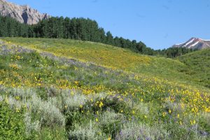 Snodgrass Mountain, head out pretty early for the drive to put us on the trail by 8:30 or so. The area is amazing with entire hillsides painted mostly shades of yellow but dotted with purple, blue, red, white and orange. Snow capped peaks ring the valley along with the namesake crested butte. Wow! We hike about 4 miles through meadows and treed terrain. What a great time of year to be here.
 The pictures don’t do it justice. Two marmots cavort on the rock pile providing lunchtime entertainment. We won’t be finishing the loop drive. We meet a Crested Butte bound driver who reports that some earlier driver overestimated his skills and is stuck in remaining snow pack. They have blocked the road and no one is getting through. So, home we go.
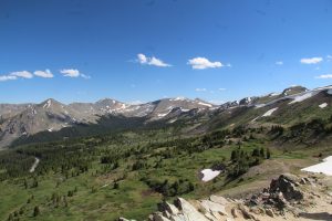 There are switchbacks and hairpin curves and quite a bit of traffic but the drive is lovely and pretty easy. We are in the Sawatch Range and the pass is at 12,119 ft elevation, the highest paved crossing of the continental divide in the US. We hike up another couple hundred feet to an amazing view on a trail that winds through a wildflower covered alpine meadow. It is beautiful in every direction. Trails go on from here but we hang for a bit then head back down then to camp for a quiet evening. The host says there was a bear in camp last week. I’ll believe it when I see it!
 Then, we are on to Monarch pass via US50 to check out the view from 11,312 feet and with a gondola ride up to the top, 12,000ft. The gondola ride is a bit exciting as the cars bounce in the wind. It is clear and we see Pikes Peak and The San Juan Mountains, about 80 miles. We hang and enjoy the views for a bit then are on our way. The rest of the day is filled with some shopping to restock and prep to move tomorrow. On to Crested Butte and a quiet National Forest Campground, Lottis Creek.
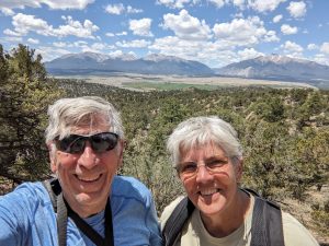 , a walk through wild space with hopes of seeing deer maybe elk and maybe even bear. It is rugged and beautiful as we move along first an old two track road then dry stream beds. Granite monoliths rise high above us with pinon pine and juniper in the valleys between them. We do notice there is not much shade and that the trail is often soft sand underfoot. Neither is what we were expecting. We manage to get off trail following the path of what must have been a trail ride. We wind up trailblazing up and down three ridges and their associated troughs. It’s getting hot and we are a bit tired and exasperated at the difficulty finding the trail. One more climb and tada, we are back on the trail and heading for high ground where we find fantastic long mountain views out over the valley to surrounding 14000s. We are feeling the heat and elevation so cut the hike a bit short and head back. So far one cottontail and a couple chipmunks. Good thing the views were nice.
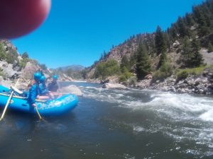
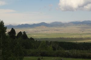 Check out this view from our site.