The motorhome is going into storage and we are making a 30 day 4800 mile loop in the truck. It is a bit of a milk-run trip and we need wheels at every location so it seems to make more sense than flying. We will see. Our route: Houston – time with Brian, Louisville – time with Sayre family, Letart, WV – Kent’s 50th H.S. class reunion, York, PA – a little Wasik family time, and NY – Kingston family time and Willa’s 5th bday then back to South Fork CO to the rig. Whew!
Day 1: CO 160 across Wolf Creek Pass at 10,857ft. It is a beautiful ride through a wide green valley then a climb into snow-capped mountains. We make a stop and short hike to Treasure Falls. 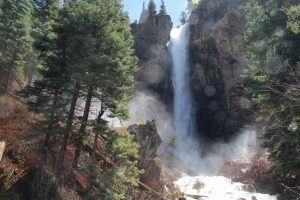 Swollen with snow-melt the water roars across the rock ledge and spray completely engulfs the upper observation deck. I get drenched. It is pretty cold up here!
We roll into camp, Grand View Cabins and RV, mid-afternoon and spend the rest of the day relaxing, packing, and watching a very friendly group of mule deer who make themselves at home in the campground. One even beds down right by our picnic table.
I have a few hours so I trial Willa’s vanilla vegan b’day cake recipe. What a mess! It rose to the top of the pan but then fell to just ¾” high. It tasted ok but the sugar sort of caramelized all around the edges and it stuck to the pan so bad I had to scrape it out. I blame it all on a combination of a new recipes (my first foray into baked goods using aquafaba) and we are at over 8000 feet elevation. I’m going to have to try this again once we get back to more normal conditions!
Day 2: The motorhome is all buttoned up and stowed away. We point the truck southeast, Amarillo bound. The road stretches in front of us straight and flat. It is a bit windy. Dark, stormy looking clouds many trailing streamers of heavy rain form and disperse in front, behind to the right and to the left. Bolts of lightning streak to the ground. It is amazing to watch. We catch up to, or it catches us, some heavy rain. No real problem but it does cool things off for a bit. We spot prong horn antelope, some lone wanderers others in small bands chill’n and munching. Weather is still unsettled when we make our stop in Amarillo. Fortunately, the golf-ball sized hail produced by some storms never falls near us.
Day 3: panhandle to hill country. We spot two prong horn calves, roll by cotton fields and even a gin, then discover that Texas is the second largest grower of peanuts in the US. We are heading for Brenham TX with an eye out for spring wildflowers and looking forward to a stop at Blue Bell Creamery and a chance to sample a couple flavors.
Day 4: Washington on the Brazos SHS, all about the years of TX as a Republic – how it came to be, what it was like, what it means to TX and Texans today. There is a huge Museum of the Republic here too. We save that for another time. Now we are off to Blue Bell! They don’t do tours anymore but there is a great observation deck overlooking final production stages: flavoring and packaging from single serving to 5-gallon tubs. The newest flavor (Texas is all a-buzz) is Dr Pepper float. Nope, not for me! We go for strawberry and southern blackberry cobbler and are very happy with our choices. Next stop, Brian’s place.

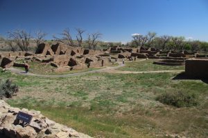
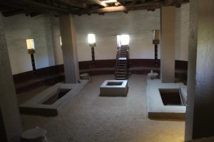 Ruins National Monument. Museum displays compare and contrast the Pueblo and Chaco civilizations through their pottery, architecture, and building techniques plus try to connect the dots between those populations and the many native tribes that have and still do occupy these lands.
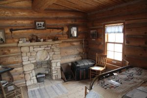 complete reconstruction of the 1880 settlement. Descendants have contributed items from the actual period and tell the stories of hardship and determination in the words as passed down through their families. One can visit other sites along the Hole-in-the rock Trail. They are very remote in rugged country. We’ll settle for this insight into the journey.
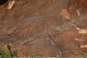 River is a huge petroglyph panel. Hundreds of figures cover the heavily patinaed sections of the cliffs along the river flood plain. It is inside Sand Island campground in an area that sees lots of foot traffic. There has been some vandalism but a great number of the figures are still visible. We are on a scavenger hunt for a Columbian mammoth with a bison figure overlaid. It is highlighted at the Education Center as it dates the site to over 13,000 years ago. We didn’t find it but still, a fun and amazing stop. I wonder what the original authors are thinking as they hear us speculate as to the intent of these writings.
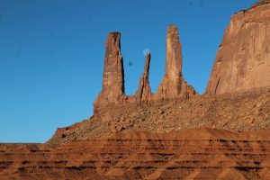
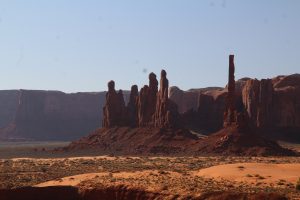
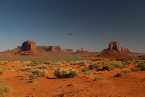 The road is not as bad as many reviews declared but not great either. Kent makes it around in 2-wheel drive, so not too bad. Prominent buttes are named, some easily identified like “the mittens” others like “the elephant” require a bit more imagination and a view from just the right angle. It is cool to wind our way among them as shadows change with the rising sun angle. My favorite is probably the totem pole and adjacent dancers, The Yei Bi Chei. We leave with a lot of pictures! I am not certain which drive is the more impressive, Monument Valley or Valley of the Gods. Monument Valley is immense and the raw scale as we move through it makes one feel small in comparison. The drive through the narrower Valley of the Gods brings us closer to the features making it seem like a more personal experience. Both could be improved by removing distracting human intrusions: boondocking RVs all over Valley of the Gods and rooftops of homesteads among the buttes of the Tribal Park. Both have tipped too far in the scale balancing right-to-use and preservation, in my opinion. But yes, I too would have loved to have spent a silent night under a star-filled sky in Valley of the Gods.
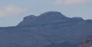 namesake, Bears Ears Buttes. We are out along Colorado 95 checking out Puebloan ruins and get a pretty good outline on the horizon.
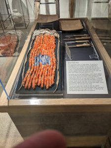
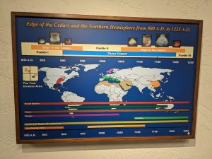
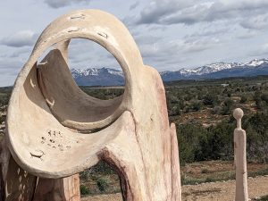 Stuff I didn’t know or never saw: stone arrowheads on a yucca strand to be carried like an ammo cartridge, a chart comparing the eras of world civilizations – the Anasazi span is remarkable, a sculpture demonstrating the use of shadow and sun-light beams for telling seasons and “time”. We have made our way through a number of museums housing similar artifacts. It is fantastic to come across something new. There is a partially excavated and restored Pueblo Village on the ground. We explore including checking out the inside of the Kiva. Edge of Cedars is definitely worth a stop.
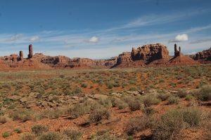
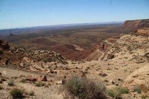
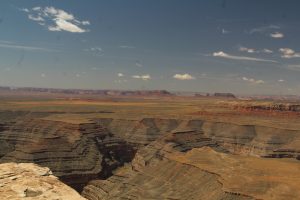 . We start with Valley of the Gods, a smaller scale Monument Valley. 17 miles of narrow gravel road wind through a field of redrock formations. Shadows and colors are beautiful in the morning light.