Finally!

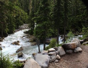
It is actually sunny when we get up, 45F but sunny.  I will take it.  We dawdle over breakfast and it warms up a few more degrees before we head out to an easy, short local trail, Meeting of the Waters.  Camp is full as is the day use lot and several large groups funnel toward the main trailhead at the end of camp.  There are lots of trails in this area though and before long we have our little stretch of woodland to ourselves.  It is any easy stroll to a log bridge just below the junction of two rushing, glacier melt streams, the Illecillewaet River and Asulkan Brook.  High above us the sun lights up jagged mountaintops, with a fresh dusting of snow, in a brilliant blue sky dotted with fluffy clouds.  Nice.  It spits rain but we are undaunted and extend our walk along the 1885 trail.  We hope for a good view of camp from across the river but no such luck.  I take the opportunity to scan high meadows and spot a dot…a bear digging up goodies.  He is much to far away for a good picture but with binoculars I am certain it is a bear working across the open field.  Just one more excuse for a more high-powered telephoto lens, right Kent? 

Break…we relax in camp a couple hours then head out to join a ranger led hike.
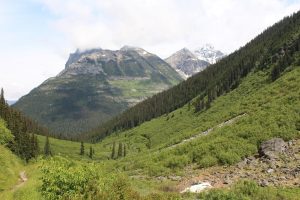
The hike is on Balu Pass trail.  Oh yes, Balu as in the Bear!  The trail passes below Grizzly Peak, Ursus Major, and Ursus Minor through an area of prime bear habitat.  It is one of the areas in the national park that require (as in fine $115 if you don’t) hikers to travel in groups of 4 adults, minimum.  Large groups tend to be noisy and noisy groups rarely startle bears.  That is good…for hikers and bears.  We meet a pair of hikers who apparently ignored the grouping rule, they are being escorted down off the trail by an enforcement Warden.  

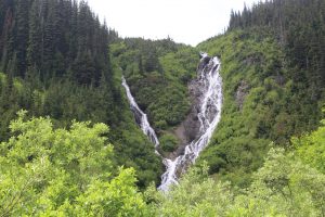
Our Ranger steps pretty lively up the first three switchbacks.  Most of us are breathing heavy and we lose a group of about 10 who are expecting more of a stroll than a hike.  Still, we are a group of 8 so safely on our way.  No great new revelations as to bear habits or behaviors and we don’t actually see any bears but it is still a great walk. These mountains are amazingly steep resulting in impressive avalanche slopes throughout the back country.   Bears love the wildflowers and berries that pack these open meadows.  We spot hoary marmots basking and playing in a boulder field.  We review a bear scratching tree where the Grizzlies rake the bark and leave hair and scent for other bears.  Our turn around point is at the base of three impressive waterfalls where snowmelt gracefully spills down the mountainside.  The water is about as cold as you might expect…brrr.    I would take this walk again.  Next time all the way to the end (we went about half way) and next time a little more slowly to check out the wildflowers and give wildlife a bit more time to show itself.            
Ok, we are tired now

The campground sits in a bowl surrounded by peaks 8500 to 9500 ft with glaciers adorning the high-altitude flanks of many of them.  We didn’t climb a peak today but we did hike Glacier Crest, the ridge formed between the Vaux and the Illecillewaet glaciers.  Total, 3 1/2 miles each way with 2700 feet elevation change.

We wake to overcast skies and by the time we finish breakfast it is raining.  Rats.  We wait it out and as the temperature comes up just a few degrees the rain stops.  We are off.  Things start pretty easy as we head back along the river and cross the milky glacier silt laden stream.  A few steps beyond the bridge our trail branches off and climb begins in earnest.  First it is long steep switchbacks one after another.  Just when we think that is tough it devolves into an even steeper rocky sheep trail that seems to go on forever.  Humidity is high in the dense pine forest and the climb is exhausting.  We make a few stops to rest and to check out the wildflowers and the mountain views.  There are spots of blue sky and brilliant sunlight on the mountain snow caps.  Our journey ends in the boulder field near the top of the ridge where we find a perfect spot to relax and take in the view.  A pica pokes its head out from among the boulders for just a moment.  They are even cuter than marmots.   Today is a good day! 

Glacier Crest

Gotta go back down.  The steep grade pounds the knees and loose, uneven rock, and a bit of mud from the earlier rain, threaten to twist ankles.  We are home relaxing with the sun on our faces and the Illecillewaet River dancing at our feet.  Today is indeed good.    

A quick trip to Mt Revelstoke National Park

Meadows in the Sky Drive is just 25 km but takes you from the cedar and hemlock forest of the Columbia River valley to an alpine meadow.  At the entrance station we are reminded to be on the watch for bears, they active right now.  Cool!  Red, yellow and blue wildflowers line the steep switchbacks and every direction provides a view of a different mountain range.  The panoramic view from the top is beautiful but hazy skies and mountain top clouds keep it from being spectacular.  We stroll among patches of snow and amazing, lots of mosquitoes.  Trails to back country alpine lakes originate up here too but we will have to save that for another day, it is already after six and the road closes at 8:30.  On the trail back to the car the clear notes of Thrushes float from the tree tops.  Pesky Gray Jays patrol the picnic area.

Some dummy discharged a can of bear spray in the pit toilet…wow, no wonder the furry fellows run from that stuff!  Kent and I cough and sniffle for good half hour and we didn’t even get it right in the face.

Heading down.  No bear but a good look at an adorable marmot.  He stood up when Kent whistled at him.  They are pretty big but he didn’t look very scary with a blade of grass hanging out of one corner of his mouth.  Very cute.  A bit later a long skinny weasel looking fellow raised up, maybe a fisher?  I am not sure what he was but he seemed as interested in us as we in him, then he scurried off.   We are home for a late dinner then off to bed hoping for better weather tomorrow.  The forecast is not good.

Leaving Arrow Lake

Next stop Glacier NP but the journey is part of the fun.  Just out of Nakusp we spot a huge raft of logs on Arrow Lake.  Looks like that is how they bring timber from the west side, they float it across.  That time-proven lumbering practice is alive and well here.   We motor on heading for one of the great rural Canada travel phenomena, the car ferry.   Highways just end at one side of a lake or river and resume on the far side one short boat ride away.  Before long we add to the que on the approach road; motorhomes, lumber trucks (they don’t float it all across it seems), motorcycles, a horse trailer, and the usual cars and trucks.  We have time to kill so I head for the bank to watch the ferry come in from the far side of the lake.  It is huge (later I see a placard indicating 1,500 tons max gross weight).  Loading begins, trucks and motorhomes to the center and cars and pickups on the outside lanes.  We look tiny next to a full load of cedar logs!   It is smooth sailing so we get out to snap a few pictures and in just 20 minutes we are back on the highway.  Even with a bunch of construction on Canada 1 we make it to Glacier NP and Illecillewaet Campground before noon where Kent finds a great site right on the Illecillewaet River.  Sweet.  I check out the afternoon program all about early female mountain climbers.  It is a great story as the women not only took on the challenges of the mountains but also the men of their time.   Afterall, mountain climbing isn’t very lady-like and certainly can’t be done right in a skirt.

Strolls, hikes, and tastings

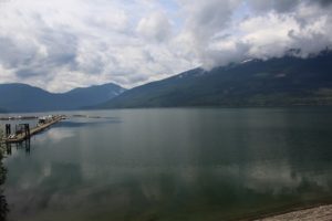
Nakusp makes a pretty good stop to do a little exploring of this rugged country.  We start easy, the paved lakefront walk along the shore of Arrow Lake right in town.  Saddle Mountain rises high above Arrow lake where scattered kayaks, canoes and the occasional power boat slice through the still water.  I spy an ice cream shop where I relax in the sun with an English toffee milk shake and Kent his hot fudge sundae. 

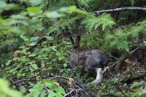
A bit more challenging, a nature trail through lush cedar forest.  It has more elevation change than we expected and is intertwined with cross country ski loops resulting in a few minor navigational errors; still, the walk is peaceful and enjoyable.  We spot a summer colored snowshoe rabbit…check out the telltale big feet.

Today’s biggest challenge, 1200ft elevation change on a steep/really steep mile to a lookout, Vicki’s View, above town and the lake.  Overcast skies and a bit of haze mute the colors but the view is still worth the walk.

One more stop, Burton City Cidery.  This place is way off the beaten path but I just have to check it out.  The base cider is dry and not very sweet.  I try almost every offering:  Apple-ginger is a bit over powering, Apple-berry versions just don’t quite suit.  I skipped the one with added hops – definitely not my thing.   I come home with a 2-liter growler of my favorite, Apple-n-Rye, Rye whiskey barrel aged apple cider.  I am going to try not to drink it all before the kids come visit.

What a ride

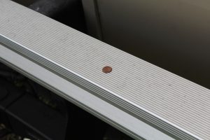
This morning while hooking up the car for towing I noticed a penny on the ground.  I placed it on the back bumper of the motorhome and continued the hookup process, then promptly forgot it until we were moving down the road.  Some 160 miles of 2-lane, up to 11% grade and it made the trip for the entire day.  Guess the road was not as rough as I thought.

That 11% grade for 4 kilometers is by the way the 1st time I have noted 4 “runaway truck ramps” on one hill.

North to Canada

Day 3

Today we cross into Canada.  Passports in hand, check.  No fresh produce, check.  Drank up the wine, close enough.  We are ready.  Questions at the border seem to go just fine.  The agent takes our passports and says he’ll be right back.  No problem…we think.  He returns, “we will need to look inside” he says.  Kent and I pile out.  I say nothing, that seems the most prudent action in situations like this, but I must look perplexed.  “You didn’t do anything wrong”, the agent says as he climbs into the cab.  We hang out for maybe ten minutes as they look around inside and in outside compartments then send us on our way.  Seems it was just luck of the draw.

Our drive hugs river banks; first the Columbia, then the Slocan, then the Columbia again.  Sometimes we share narrow twisting valleys alongside white water and others we follow the shores of broad slow moving “lakes” created by hydro dams all along these rivers.  Thanks again, Kent, for the stress-filled driving.  The views are beautiful.  We see lots of wild turkeys; many with little ones.  This is bear country but none makes an appearance today.  We plan to overnight at the Municipal Campground in Nakusp, BC.  Not happening, it is closed for a rally, Horizons Unlimited.  No cell service makes finding an alternative spot a little dicey but we settle in at a commercial camp, KBR, and all is well.  We are here two nights to allow for a little exploring. 


Day 2

We climb up out of the Snake River Valley at Lewiston then US 195 takes us back into farm country.  It is on an even bigger scale here as cropland stretches out as far as the eye can see.  It isn’t exactly natural but it is impressive and beautiful in its own way.   Makes me think what the great plains must have looked like for the early settlers.  The scale is mind boggling.  Small towns hug the highway including Uniontown, the home of (among other things I am sure) Jacobs Bakery.  This is scone country and both the blueberry and lemon poppyseed are fantastic.  We drive on.  Smooth rolling plains give way to steeper slopes and increasing stands of pine.  Hills transition to mountains as we head further into Washington to Kettle Falls, our last overnight stop in the US as we head to the spectacular Canadian National Parks.  The local natural foods market had a nice selection of Pacific Northwest wines. Rascal Pinot Gris from The Great Oregon Wine Company paired nicely with our dinner salad (we had to finish off all those fresh vegetables).             

Day 1

US95 cuts through seemingly endless fields of onions before finding its way to the twists and turns through the narrow, lush valley of the Little Salmon River.  Cabins and fish camps dot the riverbank.  There is no cell service out here and its 50 miles to groceries but I can see the appeal.

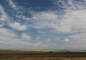
We emerge from the river valley onto vast rolling hills draped with a colorful patchwork of contour plowed, rotated crops.  Varieties of wheat range from a pale green-grey to deep forest green.  Brilliant yellow mustard blossoms seem to glow in the sun and a sweet smell fills the cab.  Austrian peas bloom white and lacy tops of canola move in the breeze.   They grow mint too.  There is no mistaking that fragrance as we pass by.  No, despite years of observing as we travel, I can’t recognize what is in the fields.  There are roadside signs that identify the crops for passing inquiring minds.

We call it a day just short of Lewiston and overnight at a Clearwater River Casino.   Ok for a quick stay over.  It gave us a chance to check out the Nez Perce National Historic Park visitor center…. the movie was pretty good but otherwise not too impressive.

Independence Day in small town America

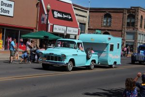
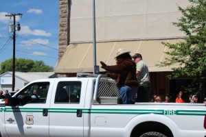
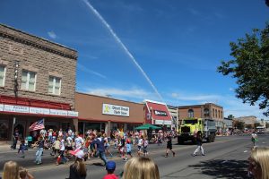
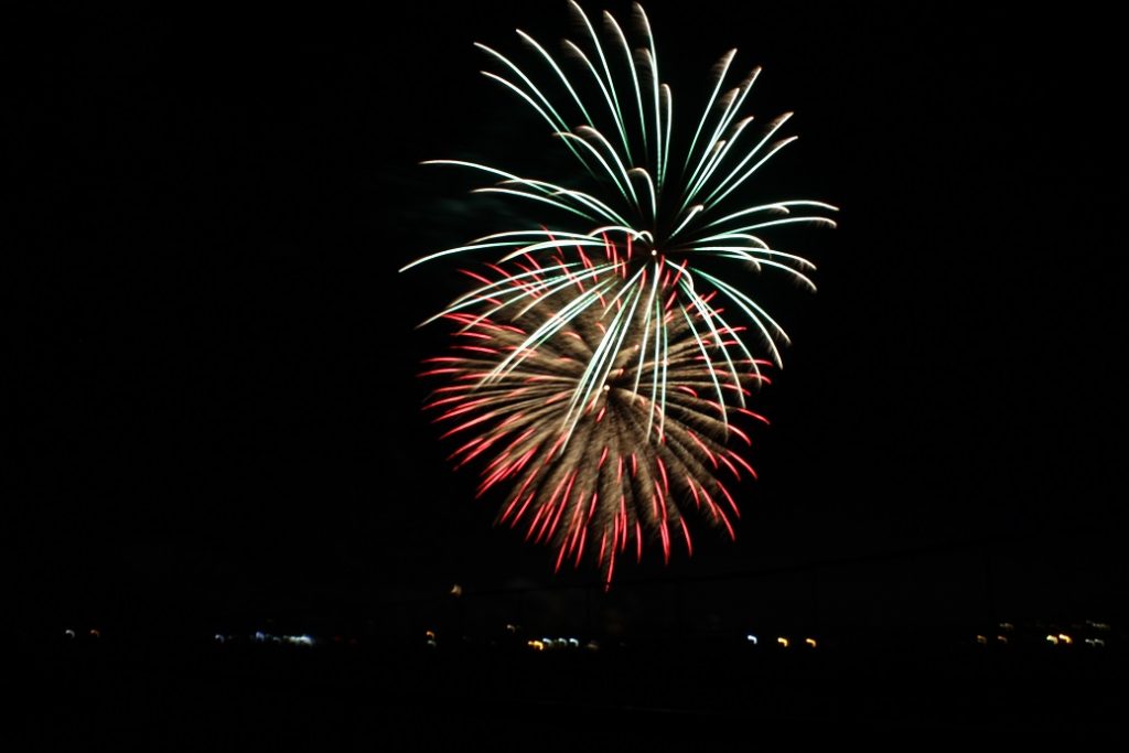
The small town for us, Burns, Oregon.  Start with a parade.  Follow it with a free community BBQ.  Throw in a grilled hotdog picnic supper.  Wrap up the day with fireworks.  That is a classic Independence Day.  Parade highlights included Smoky the Bear and a BLM super soaker (a tanker truck with a huge pump and nozzle) that they sprayed along the parade route for the kids to play in.  We skipped the BBQ and opted for another fundraiser lunch of ribs and the trimmings.  The fireworks show was nicely done.  It gets a few extra points since we could watch it from our lawn chairs in camp.  Kent got a few pics.    

Toward Boise

Today we plan to make it a far as Hines/Burns Oregon.  It is a nice distance to break up the trip and they have Independence Day Celebration activities scheduled.  I do love fireworks.  US395 crosses mountain ridges and broad valleys blanketed in scrub and hay fields, hugs the shore of several large lakes, and passes through a few sleepy little towns.  From high spots the view seems to go on forever where the distant mountains meet the endless sky.  We spot prong horn antelope along the way!

Modoc NWR

Thanks to the acres of wetlands, mosquitos are by far the most numerous wildlife in MODOC!  They are so thick during an evening drive through that we don’t even get out of the car.  The coolest sighting of the evening is all because of them, a huge flock of night hawks.  Typically, we are lucky to get a quick glimpse of one or two of these acrobatic buggers just before dusk but tonight a flock of twenty or more swoops and dives through the bug filled air over pond and wetland.  It is an amazing sight. 

Sand Hill Cranes nest here in wet meadows.  Seems they feed in shallow water too.  I have always thought of these big birds as plains feeders and dwellers but today I see one wading.  It looks so out of place but it seems this is typical behavior during breeding and nesting.  Learn something every day!

Mule deer graze on high grass and doe shelter young fawns on islands, smart.  California Quail scurry about and from their perches atop scrub brush send out alarms.  The distinct calls of cranes and geese fill the air along with the warbles and rasps of red-winged and yellow-headed blackbirds.  Waders and ducks add to the noise; not in the large numbers seen during migration but many different types are still represented.  We even manage to walk a short trail during the cooler morning hours before the mosquitos really get going.